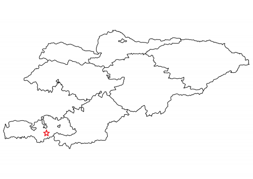
«Chakush» deposit
Kyrgyzaltyn OJSC has License No. 7361 AR dated July 17, 2023 for the right to use subsoil for the purpose of geological exploration at the Chakush deposit.
The size of the licensed area is 978 hectares.
The Chakush deposit is located in the Batken district of the Batken region. The licensed area is located on the northern slope of the Alai ridge on the left side of the Sokh river.

Absolute altitudes are 1500-2400m. Economically developed area, in close proximity to highways, power lines, water supply sources (Sokh river).
The distance from the deposit to the village of Aidarken by road is 55 km, and to the regional center of Batken is about 80 km.
The deposit is an integral part of the Chakush gold ore field, which is part of the Sokh gold ore cluster - a metallogenic unit of the Turkestan-Alai gold belt.
The geological structure of the deposit includes volcanic-terrigenous rocks of the Silurian (clayey shales, basaltoids), on which lie calcareous sandstones intruded by granodiorite intrusions.
Ore mineralization, including gold, in the area of the deposit is established in two geological positions: in quartz veins with sulfides and in metasomatites.
In total, the predicted resources of category P1 for the deposit are 6.1 tons of gold, P2 are 14.7 tons of gold.
Other projects


